A recent soil testing workshop brought Geographe farmers together face-to-face and online to get a better handle on their soil nutrients.
Thirty-six farmers were involved in this year’s soil testing program, with over 20,000 soil samples collected across 688 paddocks.
The workshops are part of the Geographe Soil Testing program which aims to give farmers greater confidence in planning their fertiliser program by providing them with nutrient maps of their properties based on results of whole farm soil testing.
This year the workshops were held online as a three-part series, with one face-to-face workshop to collect maps. The modules included how to determine production targets, how pH can impact nutrient availability and how to fine-tune nutrient budgets to cost effectively meet production aims.
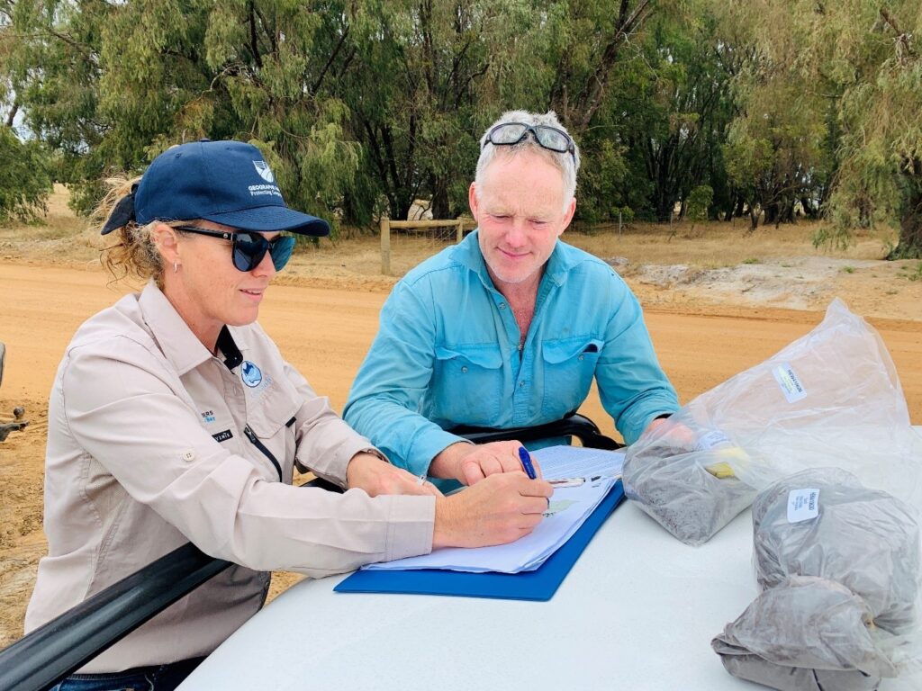
Agronomists were on-hand to help farmers interpret their maps and soil test results.
Local farmer Rebecca Slade said she would highly recommend the soil testing program to those who wanted to get the most out of their farm.
“I wanted to know how to better read a soil sample, and where my dollars are best spent” said Rebecca.
Soil testing is a critical step in best practice fertiliser management. It provides farmers with vital information about what nutrients are in the soil and identifies any deficiencies that may impact pasture growth.
GeoCatch Project Officer Kim Archer says nutrients such as phosphorus should only be applied to meet production requirements.
“Nurients applied that are excessive to the plant’s needs can leach into groundwater or runoff into local waterways” said Kim.
“Excess nutrients from farm runoff can then contribute to algal blooms and fish kills that we see in our local waterways and estuaries” said Kim.
Since 2009, 178 farmers have participated in soil testing in the Geographe Bay Catchment, with an estimated reduction of 4.7 tonnes of phosphorus entering Geographe Bay since the start of the program.
With beef and dairy grazing contributing the largest source of nutrients entering local waterways, working with farmers to improve fertiliser management is a priority for GeoCatch.
This project is part of Royalties for Region’s Healthy Estuaries WA and Revitalising Geographe Waterways programs. These State Government initiatives aim to support the long-term health of our south-west estuaries.
If you’d like to be involved in the next soil testing program, contact GeoCatch.