If you participated in this citizen science survey, thank you for contributing to the conservation of the critically endangered Western Ringtail Possum.
The Tally results will be shared later in the year!
Citizen science survey
What is the Ringtail Tally?
The annual Ringtail Tally was established by GeoCatch in 2016, in partnership with Department of Biodiversity, Conservation and Attractions (DBCA). The Tally aims to improve our knowledge and awareness of critically endangered Western Ringtail Possums living in urban areas. Usually held in the autumn school holidays, the Tally is a fun and informative way for community members of all ages to engage in science and the conservation of a critically endangered species.
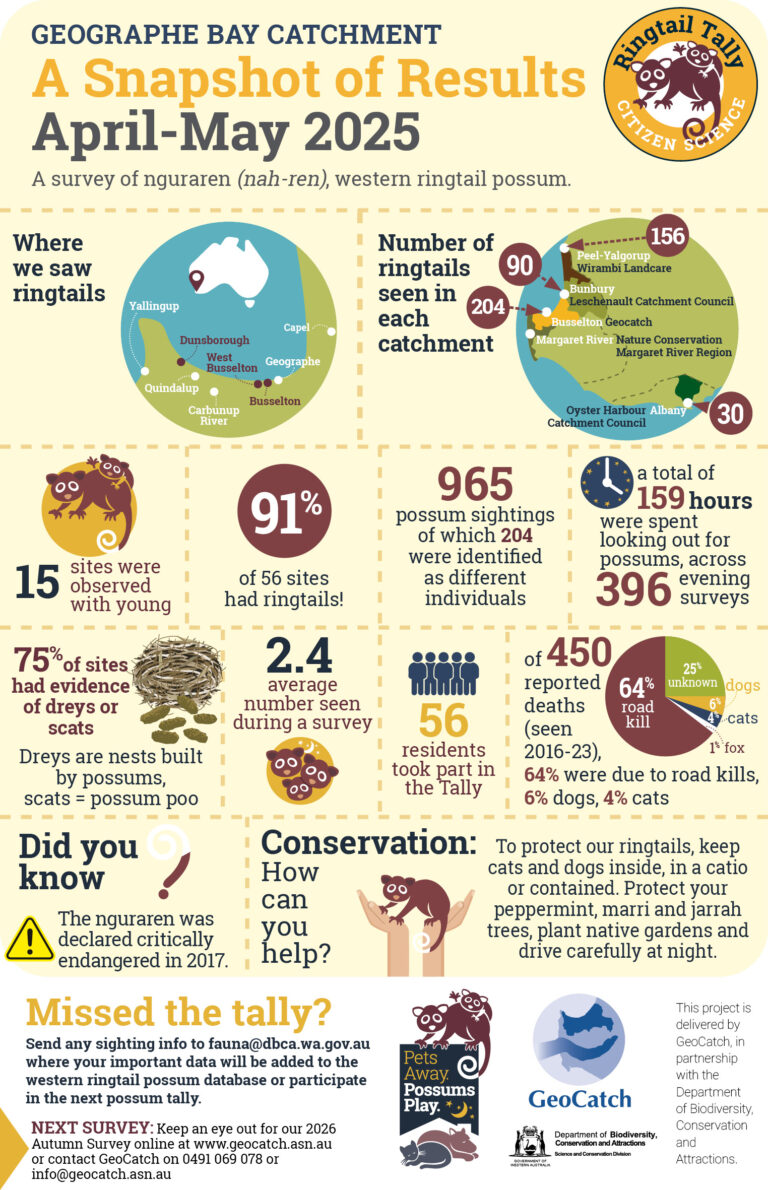
Citizen scientists are engaged to record sightings of possums in their local area over a 4 week period during April to May. The results are shared with the wider community in the form of an infographic and recorded on the WA Threatened Species Database.
The information gained from the Tally is building a reliable set of observation data that will improve our knowledge about where Western Ringtail Possums are found and in what numbers. This information is then used as a reference for population trends, future planning decisions and conservation projects. The data becomes more valuable each year the Tally is repeated. A Summary Report collates the data findings from all the tallies completed.
Extending the Reach
Impact beyond the Geographe Catchment
Since its inception, the Tally has expanded beyond the original Geographe Bay Catchment area. Nature Conservation Margaret River, Leschenault Catchment Council and Wirambi Landcare now run the project with their local communities, and South West Catchments Council assist with coordination, making it a truly regional event.
The ongoing success of the Tally is not possible without the generous contribution of community participants, DBCA and partner organisations.
See the results of previous years
Past Ringtail Tallies
Take a look at our findings from past Ringtail Tallies in the Resource Library.