Revitalising Geographe Waterways Report on activities 2020–22
Revitalising Geographe Waterways aims to improve water quality, waterway health, and management of Geographe waterways. It is part of the State Government-funded Healthy Estuaries WA program which supports restoration and management activities across regional estuaries. Revitalising Geographe Waterways has been overseen by the Vasse Taskforce since 2014, with investment from State Government, Taskforce Partners, industry […]
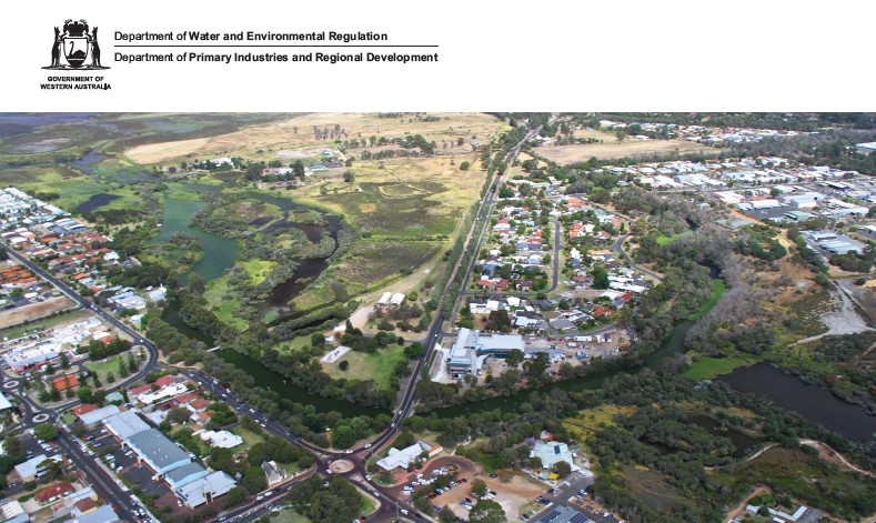
Lower Vasse River Management – Improving Water Quality
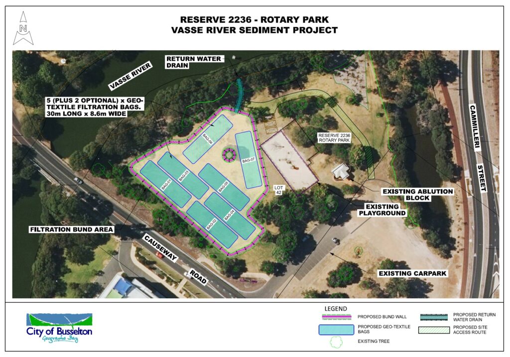
Removal of Sediment This project is part of a multi-staged approach to reducing nutrients and improving health of the Lower Vasse River. The City of Busselton aims to improve water quality of the River by progressing with the removal of sediment. Nutrient-rich sediments have built up on the bed of the Lower Vasse River over […]
25 Years of GeoCatch
Our achievements over the past 25 years are definitely a collective effort, with contributions from our farming community and urban residents, all working towards a better environment in our local catchment. At our recent AGM, we shared our achievements over the past financial year – we’ve definitely been busy!
Community learn about the Vasse Surge Barrier
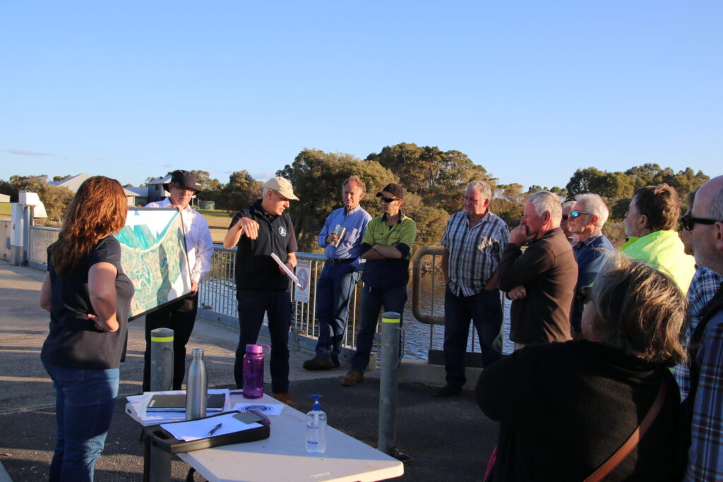
Around 20 community members have taken the opportunity to hear from managers of the Vasse Wonnerup wetlands on how the surge barriers operate and are managed. GeoCatch hosted the event at the Vasse surge barrier in response to community members asking how the surge barriers worked and how management decisions are made. The surge barriers […]
Vasse Surge Barrier Drop-in
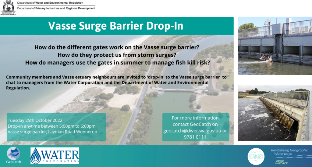
If you have ever wondered how the gates on the Vasse surge barrier work, here is your chance to come and find out. Community members and Vasse estuary neighbours are invited to ‘drop in’ to the Vasse surge barrier. Staff from the Water Corporation and the Department of Water and Environmental Regulation will be on-site […]
Looking back on the year that was
It’s that time of the year when we reflect on our collective achievements for the year. And we couldn’t be prouder of what we have accomplished! 2020/21 was an exciting year for us at GeoCatch. A major focus was working with farmers to keep nutrients on-farm and out of our precious waterways. We continued to […]
Complexity of flood protection revealed
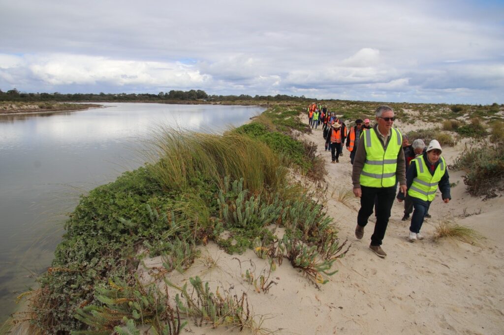
There was a full bus for the Flood protection in Busselton bus tour, as 57 community members witnessed firsthand the complexity of the local drainage network. The tour was organised in response to community concerns over flood risk during winter, visiting the Sabina River detention basin, Vasse Diversion Drain culverts, Vasse surge barrier and the […]
Celebrating 30 years of global recognition
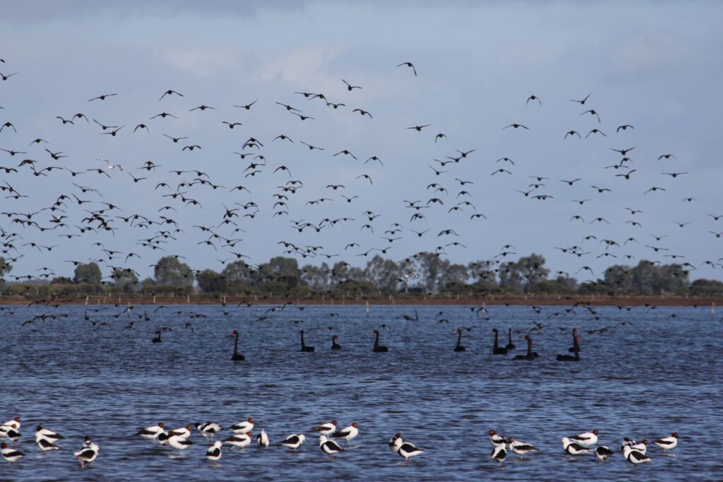
2020 marks 30 years since the Vasse-Wonnerup wetlands were recognised as a Wetland of International Importance under the Ramsar Convention. The Convention is an intergovernmental treaty that provides a framework for international cooperation for the conservation and sustainable management of wetlands. GeoCatch Chair, Felicity Bradshaw, says that this is a significant milestone for the local […]
2019/20: A Year in Review
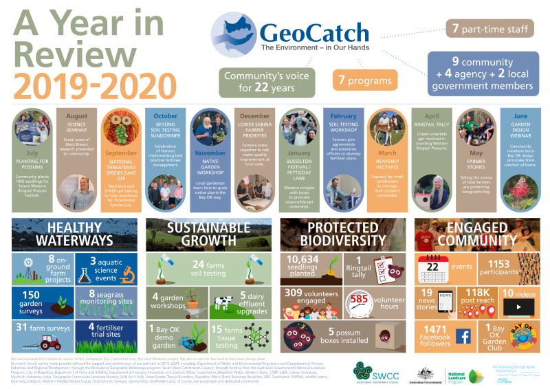
Reflecting on our achievements over the past year with the release of the GeoCatch 2019/20 Year in Review. We are proud of our collective achievements, in what was a year like no another. We are always working to do things better, do more with less and push the limits of what we can get done […]

