Search
Close this search box.
Search
Close this search box.

News

Locals learn about river health from scientists

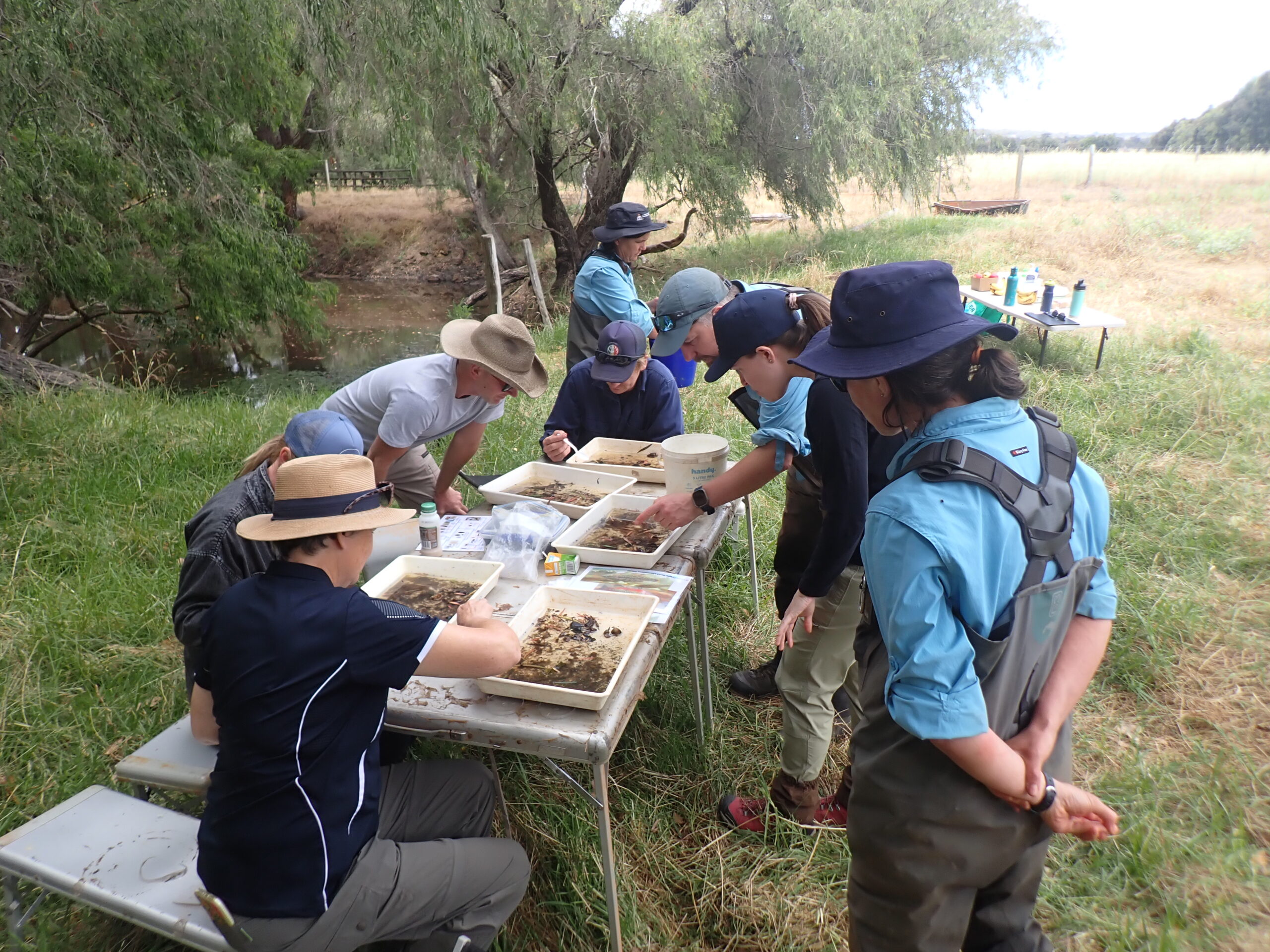
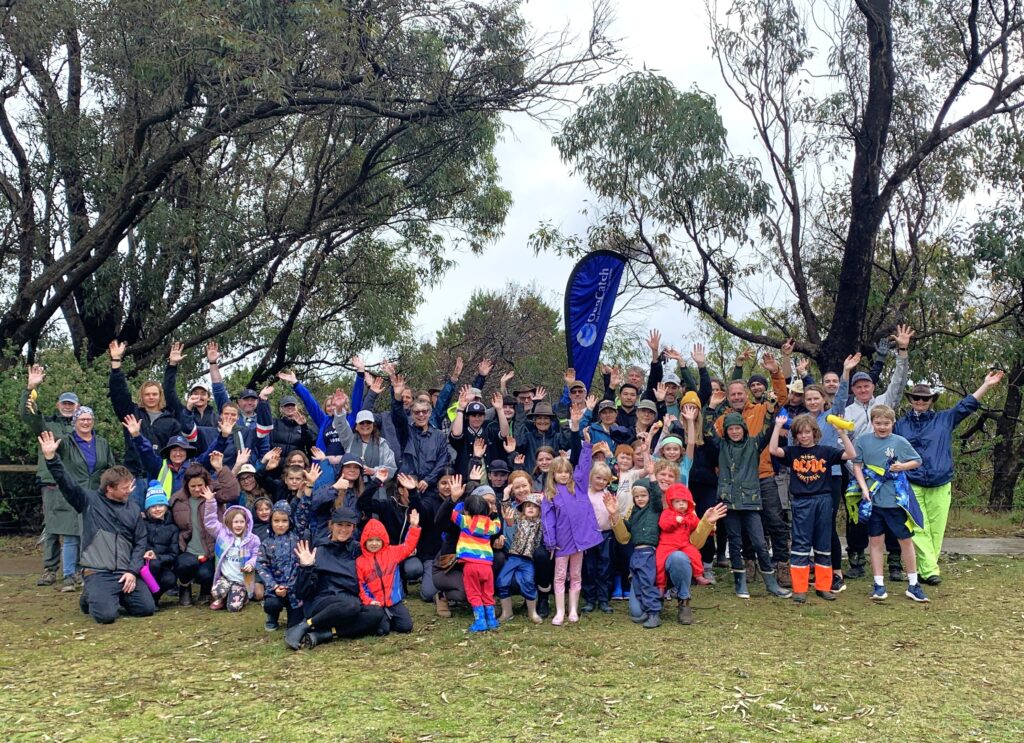
A team of scientists from the Department of Water and Environmental Regulation (DWER) shared their knowledge and passion with interested locals at a recent Healthy Rivers workshop. The river science team were assessing a stream at Station Gully, their latest stop as they traveled around the South West sampling different sites.

DWER Environmental Officer, Gina Marino, says the Healthy Rivers assessments use the South West Index River Condition (SWIRC), a toolkit developed by the Department to provide data on river health for South West WA. They collect field data on aquatic biota, fringing vegetation, hydrology, aquatic habitat, land use, physical form and water quality.

“The long-term collection of data is important as it enables us to understand the ecology of the system, assess impacts from various land uses and or stream alterations as well as aid in making management decisions,” said Gina.

The event was delivered by GeoCatch and Sustainable Agriculture Coordinator, Jenelle Schult. The attendees had many questions for the scientists who showed them different aquatic species that call the waterway home. “Workshops like these are a great opportunity for farmers and those interested in our waterways to meet and hear directly from DWER scientists. It was fantastic to see local farmers in attendance showing their interest in how to improve waterways on their properties,” said Jenelle.

Gina said it was a highlight for the team to connect with those who came along to the workshop. “It was a great experience for us to be able to share what we do with the attendees, and to see them get excited about the fish and aquatic macroinvertebrates we caught,” she said.

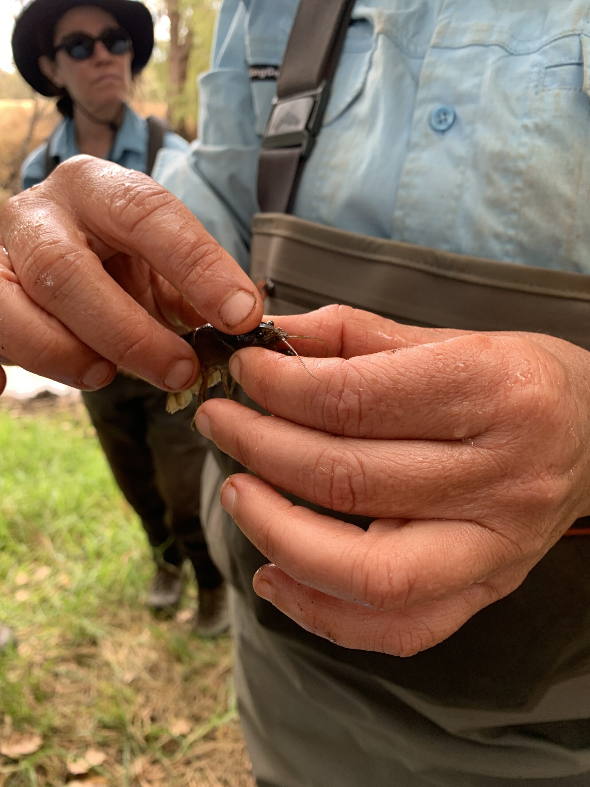
“We found all species expected at this site, including three native freshwater fish (western minnow, western pygmy perch and nightfish), two native freshwater crayfish (gilgie and smooth marron) and one non-native freshwater species (eastern gambusia). Juvenile western pygmy perch and gilgie were observed suggesting successful recruitment for both species.”

This project is supported by the Australian Government through funding from the Climate-Smart Agriculture Program under the Natural Heritage Trust. To find out more about DWER’s Healthy Rivers program visit www.rivers.dwer.wa.gov.au or to get involved with GeoCatch on rivercare and farm nutrient management projects aimed at reducing nutrients leaching into waterways, go to geocatch.asn.au/farm-management/.

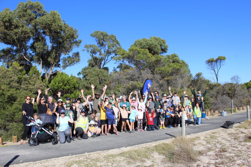
Photo 1: Healthy Rivers workshop attendees and DWER scientists getting a close look at South West river fauna. Image provided by DWER.

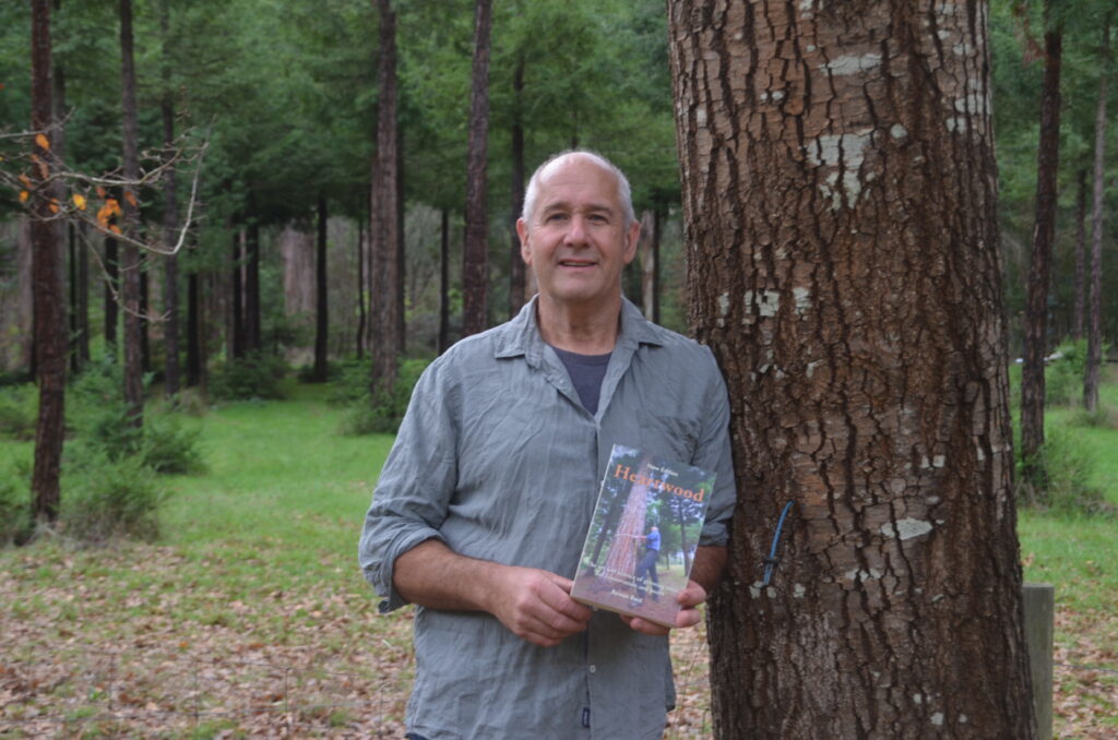
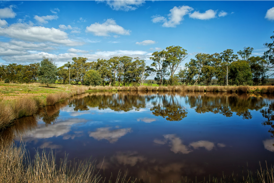
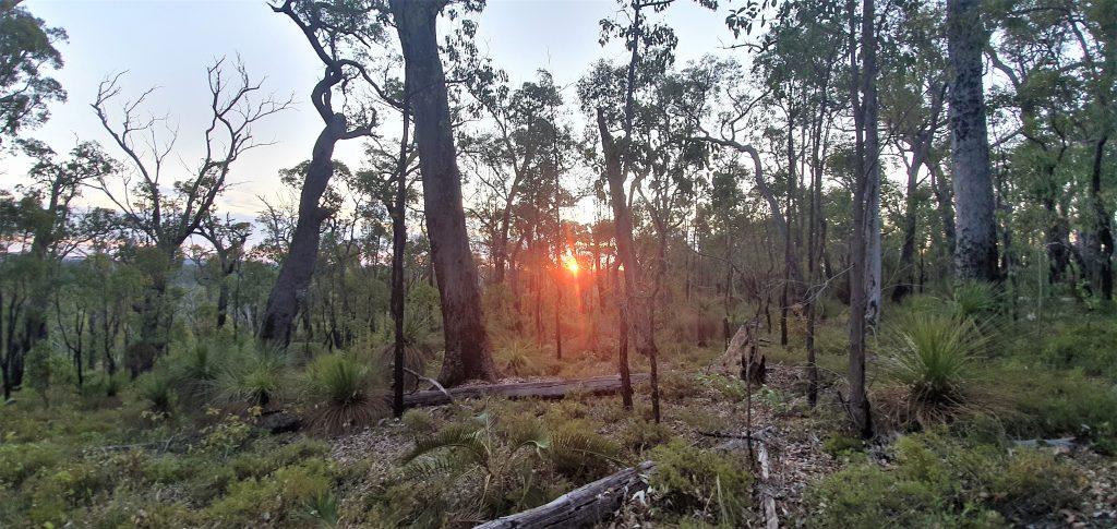
Photo 2/3/4: DWER scientists presenting findings on the ecology of the Station Gully assessment site as part of the Healthy Rivers Program. Images provided by GeoCatch.

Share

Facebook
Twitter

Related News

Receive the latest updates

Subscribe To Our Newsletter

Keep in touch with us

Join our Volunteer Register!

Buayanyup

The headwaters of the Buayanyup River occur in state forest where four tributaries flow through native vegetation before flowing through agricultural land. The lower section has been straightened into drainage channels, before flowing into Geographe Bay at Abbey.

The Buayanyup River catchment has a diversity of land uses, including beef and dairy farming, vineyards and horticulture. Native vegetation and timber plantations occur in the south eastern corner of the catchment, and the growing townsite of Vasse occurs in the lower catchment. Nutrients, particularly nitrogen, enter the river from dairy and beef grazing, dairy sheds and horticulture.

Native species, including the Western Minnow, Western Pygmy Perch , Nightfish, Blue-spot Goby, Gilgie, Smooth Marron, Freshwater Shrimp, Koonac and Long neck turtle, have all been found in the river.

Five Mile

Five Mile Brook is a small waterway in the north of the catchment. It flows seasonally to Geographe Bay near Minninup Beach. Five Mile Brook is surrounded by agriculture, particular beef farming, with some urban areas at the south of Dalyellup Estate.

Five Mile Brook has poor water quality. This is due to sandy soil, which does not retain nutrients well, and extensive grazing agriculture in the catchment.

Water sampling by local school groups has found evidence of macroinvertebrates, tadpoles and turtles.

Gynudup

The Gynudup Brook catchment consists of two main tributaries; Tren Creek and Gynudup Brook. The headwaters of Gynudup Brook are in State Forest, which then flow across agricultural land before connecting with the Capel River west of Bussell highway.

The hydrology of the catchment has been extensively modified, containing many artificial drains to alleviate water logging in winter months. Most of the catchment is cleared for agriculture, and the waterways suffer from poor water quality.

Despite being significantly altered, the waterways in the Gynudup catchment provide refuge for several native species including freshwater shrimp, Western Minnow, Blue Spot Goby, Nightfish, Gilgie and the Long-necked Turtle.

Capel

The Capel River is the largest and only perennial river in the Geographe Bay Catchment, receiving groundwater discharge from the Leederville aquifer year-round. Several foreshore reserves of conservation value are situated on the Capel River, including Ironstone Gully Falls.

Land use of the upper Capel River catchment is predominately native vegetation and beef farming. The lower catchment is dominated by beef and dairy farming with pockets of native vegetation and horticulture. The townsites of Capel and Peppermint Grove Beach also occur in the catchment.

The Capel River has relatively good water quality. Carters Freshwater, Smooth Marron, Gilgie, Freshwater Cobbler, Nightfish, Western Pygmy Perch, Western Minnow and Pouched Lamprey can be found in the catchment.

Ludlow

The Ludlow River is the only major waterway to discharge to the Wonnerup Estuary. Its upper catchment lies in the Whicher National Park, after which it flows across the coastal plain through grazing and dairy farmland, horticulture and turf farms.

These land uses contribute nutrients to the river, which suffers from poor water quality. There has been, however, a decreasing trend in nutrient concentrations in the river since 2011.

The Ludlow River retains native aquatic fauna including the Gilgie, Freshwater Shrimp, Nightfish, Western Minnow, Western Pygmy Perch and the Blue Spot Goby.

Abba

The Abba River begins in the Millbrook State Forest, flowing seasonally across the Swan Coastal Plain, through the Ludlow Tuart Forest and eventually into the Vasse Estuary. Landuse in the Abba sub-catchment is predominantly beef and dairy farming, with smaller amounts of sheep farming, vineyards and horticulture.

Ecological surveys of the river have found a diversity of native fish and freshwater crayfish including the Western Minnow, Nightfish, Blue-spot Goby, Western Pygmy Perch, Gilgie and Freshwater Shrimp.

The Abba River is categorised as an ‘intervention’ sub-catchment for water quality, where it meets phosphorus targets, but not nitrogen. Fertiliser for pasture is the largest source of nutrients to the river. We work with landholders and our partners to reduce these nutrients by fencing waterways, fertiliser management and dairy effluent upgrades.

Sabina

The Lower Sabina River flows into the Vasse Estuary. It is separated from its upper catchment, which is diverted into the Vasse Diversion Drain.

The Lower Sabina catchment is small, mostly cleared, with agricultural landuses dominated by dairy and beef farming. The river contributes a significant amount of nutrients to the Vasse-Wonnerup Wetlands.

The river supports Gilgie, Southwest Glass Shrimp, Nightfish, Western Minnow, Western Pygmy Perch and the Blue Spot Goby.

Lower Vasse

The Lower Vasse River flows through the centre of Busselton, extending from the Vasse Diversion Drain at its headwaters, to the Vasse Delta Wetlands at the downstream boundary. The river receives winter flow from the Vasse Diversion Drain through a 900 mm culvert.

The lower catchment is dominated by urban, residential development, while the upper catchment is primarily beef grazing.

The Vasse River suffers from poor water quality and in summer months experiences regular algal blooms. Despite these water quality problems, the Lower Vasse River retains significant ecological values, including a high diversity of fish and native crayfish.

Vasse Diversion

The Vasse Diversion Drain receives water from approximately 60% of the Sabina River catchment and 90% of the Vasse River catchment, diverting flow away from the Vasse-Wonnerup Wetlands and directly into Geographe Bay. These rivers were diverted in the 1920s to protect the Busselton townsite from flooding. The headwaters of these rivers originate in the Whicher Range, then flow across the coastal plain to the diversion drain and eventually to Geographe Bay in West Busselton.

The Vasse Diversion Drain catchment suffers from poor water quality, with phosphorus and nitrogen inputs high. Most nutrients come from the dominant land uses of beef and dairy farming, and smaller amounts from the Busselton wastewater treatment plant.

The upper Vasse and Sabina rivers retain important natural values, including several species of freshwater fish and crayfish. The lower section of the drain near Geographe Bay has important social and recreational value to the community.

Carbunup

The headwaters of the Carbunup River begin on the Whicher Scarp in the Treeton State forest. The river flows in a northerly direction through agricultural land before discharging into Geographe Bay near Siesta Park.

The upper reaches of the river are densely vegetated, however the lower reaches have been cleared and straightened into Lennox River Drain. A weir at the junction of the river and drain prevents saltwater from impacting arable farmland. Due to the dense riparian vegetation and high phosphorus retention index (PRI) of the soil, the Carbunup river has relatively good water quality.

A diverse range of aquatic fauna rely on permanent pools of water that provide refuge over warmer months. Carter’s Freshwater Mussel and Western Pygmy Perch have both been recorded in the river.

Annie

The Annie Brook catchment has three streams – Station Gully, Annie Brook and Mary Brook. These streams begin on the Whicher Scarp and Leeuwin-Naturaliste Ridge, before flowing to the coastal plain where they are artificially straightened into drains that converge at Station Gully before entering Geographe Bay.

The catchment features remnant native vegetation, including some poorly represented vegetation complexes. On the coastal plain, the catchment is mostly cleared for beef farming and smaller amounts of horticulture and viticulture. These land uses contribute nutrients to waterways, particularly nitrogen.

The endangered Dunsborough burrowing crayfish is known to occur in the waterways of the catchment, and surveys have also shown a variety of including the Gilgie, Marron, Nightfish, Western Minnow the Western Pygmy Perch.

Toby Inlet

Toby Inlet is located east of Dunsborough and runs parallel to the coast. It is surrounded by residential areas and is of social and recreational importance to the local community and visitors.

Land use in the wider catchment consists mostly of large rural properties and agriculture. A series of headwaters, originating on the Leeuwin-Naturaliste Ridge, flow across the coastal plain where they become poorly defined. The mouth of the Inlet closes naturally over summer but is opened by the City of Busselton to maintain flushing, as nitrogen levels are currently high.

The Inlet provides habitat for the Swan River Goby, Gilgie and the Dunsborough burrowing crayfish, as well as waterbirds and frogs.

Dunsborough

The Dunsborough streams include Meelup, Dolugup, Dandatup and Dugulup Brooks. Although relatively small and seasonal, the streams are significant to the local community.

They currently maintain good water quality due to their low nitrogen and phosphorus levels. However, the streams are at risk from nutrient runoff primarily from urban and rural-residential sources, including septics, due to their proximity to the Dunsborough townsite.

The streams provide a diversity of habitat and food sources for native fauna and are known to support the Gilgie (Dandatup and Dugulup Brooks), Marron (Meelup Brook) and the Blue Spot Goby (Meelup Brook).

Jingarmup

Jingarmup Brook is a small waterway that flows seasonally across the eastern slopes of the Leeuwin Naturaliste Ridge, through the Eagle Bay townsite to Geographe Bay.

The Jingarmup Brook catchment is categorised as an ‘intervention’ catchment, meeting phosphorus targets but not nitrogen. Native vegetation and beef farming are the dominant land uses in this catchment, which is the southern most region of the Geographe Bay Catchment. 

Water quality is impacted by septics, which contribute a significant amount of the phosphorus load to the waterway, and farming practices. Nitrogen levels are currently high in this waterway. The Meelup Regional Park Management Committee have made significant efforts to restore the riparian zone on lower section of the brook, which supports local biodiversity.