Scientists undertaking seagrass research in Geographe Bay have found seagrass densities are at the highest recorded levels, following the release of the latest Keep Watch Seagrass monitoring report.
Seagrass monitoring has been undertaken each summer since 2012, by scientists from Edith Cowan University and divers from the Department of Biodiversity, Conservation and Attractions, with the project coordinated by GeoCatch. The program aims to track the health of Geographe Bay to monitor any potential impacts from nutrients that enter the bay via drains and waterways.
Seagrass meadows are excellent indicators of ecosystem health and provide vital nursery grounds for fish, help protect the coast from erosion and act as important carbon sinks. Geographe Bay supports one of the most extensive seagrass meadows in temperate Western Australia, which store more than $83 million worth of carbon.
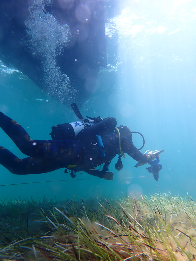
The team monitors seagrass meadows at seven shallow sites across the bay (4-5 metres deep), measuring seagrass health by laying metal quadrats down in the seagrass and counting the shoots within the square. Measuring shoot density over time gives an indication of whether seagrass meadows in the Bay are improving in condition or declining. Scientists also measure the algal growth on the seagrass leaves, known as epiphytic algae, and take samples to analyse for nutrient content. These measurements help assess nutrient inputs entering Geographe Bay from the surrounding catchment. Predicted increases in nutrients off the catchment have the potential to impact on the health of Geographe Bay seagrass meadows by enhancing the growth of epiphytic algae, reducing light necessary for growth.
Key findings from the 2025 report concluded that seagrass meadows in Geographe Bay remain healthy. Shoot densities increased at all sites from 2024, and were at an all time high in 2025 compared to other years, and other regions. The highest shoot densities were recorded at Buayanyup and Busselton Jetty, with lowest at the Vasse-Wonnerup and Vasse Diversion. The epiphyte cover declined from previous years and the dominant epiphyte types remain microalgal accumulations which are not the type commonly associated with nutrient enrichment. Nutrient content of seagrasses in Geographe Bay continues to be low with signs of higher exposure to nutrients at Capel. The higher nitrogen isotope signal at Capel suggests that nitrogen derived from animal wastes, septic tanks or from natural vegetation is also a main source.
Research Fellow Dr Ankje Frouws from Edith Cowan University said that the program is the only one of its kind currently linking potential threats from the catchment to the health of the marine environment. “This project has been a long-term monitoring success due to the sponsorship from Water Corporation to fund this work, along with ongoing support of DBCA to research the health of the Ngari Capes Marine Park and the long-term collaboration with Edith Cowan University to provide technical and field support,” said Dr Frouws.
Keep Watch annual seagrass monitoring will continue until 2026 through funding from Water Corporation.
To view the full report, visit https://rgw.dwer.wa.gov.au/applying-science/keep-watch-seagrass-monitoring/
Photo Above and Photo 2: Diver scientists monitoring seagrass meadows in Geographe Bay.
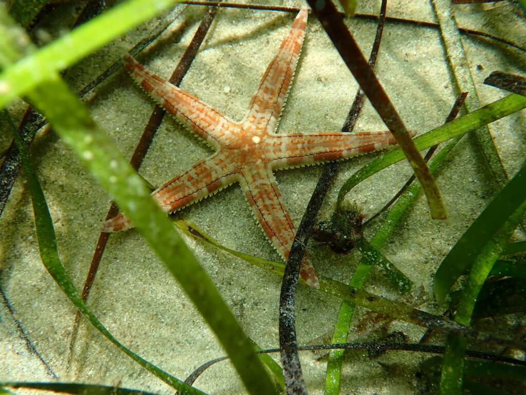
Photos 3-4: Seagrass meadows provide important habitat for marine life.